What Do We Mean By "Place"? Why Place Is More Complicated Than Just One Location In FreeREG
When family historians search for baptisms, marriages, and burials, place often feels like the most obvious piece of information to enter. Surely you just choose the parish and search?
In reality, “place” in church records is anything but straightforward. In FreeREG, the idea of place reflects centuries of local history, shifting boundaries, lost churches, and human behaviour, all of which affect where records were created and where they survive today.
To understand how FreeREG handles this complexity, we spoke with Dale Braden, FreeREG Technical Lead, about the choices made behind the scenes and what they mean for researchers.
One core idea of place - but many complications
FreeREG is built around a simple principle:
FreeREG records are organised by the place where a church is located.
That sounds simple until you look more closely.
Unlike birth, marriage, death and census records, church registers were never governed by a single national authority. They were religious documents, and there were many religious denominations. Today the registers are scattered across county archives, diocesan collections, and local repositories.
There is also no definitive historical list of every church that ever existed, nor even a complete list of all the places where churches once stood. Some churches disappeared centuries ago. Others were in hamlets that got absorbed into growing towns. In some cases, the only trace of the place left is a street name. Or just a line in a register.
This information is important because the decision was made in FreeREG to keep the distinction between the place, the church and the register, rather than combining them and losing the distinction between them.
Faced with this challenge when FreeREG was first developed around 25 years ago, the project made a key decision: instead of building a place list gradually and inconsistently, it would start with an existing, comprehensive source.
The Gazetteer: a practical foundation
FreeREG uses the Gazetteer of British Place Names as the foundation for its place list. This gazetteer includes
- Modern and historical place names
- Alternate spellings
- Geographic coordinates (latitude and longitude)
Its goal is completeness - listing any place name ever used - not specifically those containing a church. An unfortunate consequence of this is that it makes the list over complete from a FreeREG point of view. Many listed places never had a church; others no longer exist. To avoid confusion, the Places list on the Search page of the FreeREG website only contains places for which we have records in the database. The full list of places in a county can be seen by choosing Records from the main menu.
However, this approach has major advantages:
- Transcribers almost always find the place they need
- Spellings are standardised and consistent
- Places can be linked to geographic coordinates
Over time, FreeREG has corrected errors, removed duplicates, and added missing places. When a genuine historical place is absent, a dedicated Place Manager researches old maps and sources to confirm the location and assign accurate coordinates - a process that can take days.
This careful validation matters, because once a place exists in FreeREG, it becomes a stable reference point for all related records.
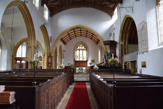
Inside St Mary's, Puddletown, Dorset (by Hugh Llewelyn). Evolving social etiquette shifted the parish name from 'Piddletown' in the 1950s (the original name came from the River Piddle). Databases like FreeREG use fixed coordinate lookups so that the name change doesn't break historical record searches.
Parish, place, and naming confusion
Church records introduce another layer of complexity: parishes and places are not always the same thing.
Parishes were often named after the local market town, but not always. Over the centuries:
- Parish churches were rebuilt, relocated, or replaced
- Population centres shifted due to industry or mining
- Chapels and mission churches became parish churches in their own right, while other churches lost this status or merged with other churches
In some cases, the parish retained its original name even after the parish church moved to a different town. In others, parishes spanned county boundaries or shifted administrative alignment altogether.
For example, some historic parishes crossed county lines, and the surviving registers may now be held in a different county archive from the one researchers expect.
FreeREG preserves what the register actually says, while linking it to a verified place name that researchers can recognise today.
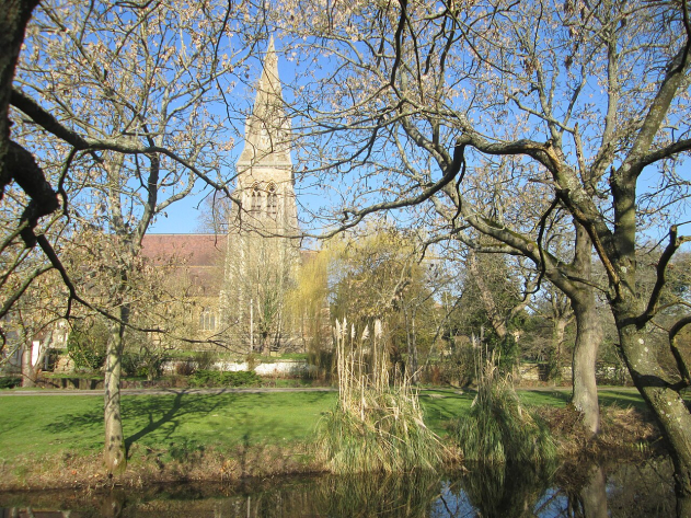
St Mary’s Church, Stratfield Mortimer (by Peter S). Though late-19th-century shifts moved parts of this parish into Hampshire, FreeREG users must look for it under Berkshire to match the platform’s strict 1831 county boundary rules.
Why GPS coordinates matter
Although FreeREG does not yet offer an interactive map, every place in the database has geographic coordinates.
This helps researchers when:
- A place no longer appears on modern maps
- A village has been absorbed into a larger town
- A historic place name survives only as a street or district
Coordinates allow users to locate where a place was, even if they have never heard of it... even if Google Maps cannot find it.
Searching by place: less is more
One of Dale’s strongest pieces of advice for users is surprisingly simple: Don’t start with place unless you have to.
People did not always baptise, marry, or bury their dead where they lived. Marriages might take place in a neighbouring parish to avoid objections. Burials might occur miles away once churchyards became full. Baptisms could happen in the mother’s home parish, not the family’s current residence.
FreeREG’s search defaults are deliberately exact. This avoids the confusion caused by hidden algorithms, but it means that overly specific searches can miss records.
A better strategy is to:
- Start broad
- Narrow by date or name first
- Use place only when needed to reduce results
Nearby Places: geography meets history
One of FreeREG’s most powerful - and underused - features is Nearby Places.
When this option is selected, FreeREG performs a radius search around the chosen place using GPS coordinates. Up to 100 nearby places are automatically included, extending the search several miles depending on local density.
This is invaluable when:
- A marriage took place in a neighbouring parish
- A burial occurred in a distant cemetery
- Families moved short distances between events
Unlike commercial sites, this feature is explicit and fully under the user’s control, not hidden inside a ranking algorithm.
Place as lived experience
Ultimately, FreeREG’s approach to place reflects how people actually lived:
- They crossed parish boundaries
- They ignored official systems when necessary
- They adapted to law, cost, distance, and circumstance
By grounding place in real geography, careful transcription, and historical awareness, FreeREG helps researchers move beyond rigid assumptions and closer to the lives behind the records.
As Dale put it, there is no single “right” way to search, but understanding how place works in FreeREG can make all the difference between a brick wall and a breakthrough.
With thanks to Dale Braden, FreeREG Technical Lead, for his expertise and extensive work documenting places in church records.